#2: The first ridge of the Himālaya
Are the Himālayan foot-hills part of the Himālayan range? Are they an independent range? Few thoughts and observations on this interesting topographic feature.
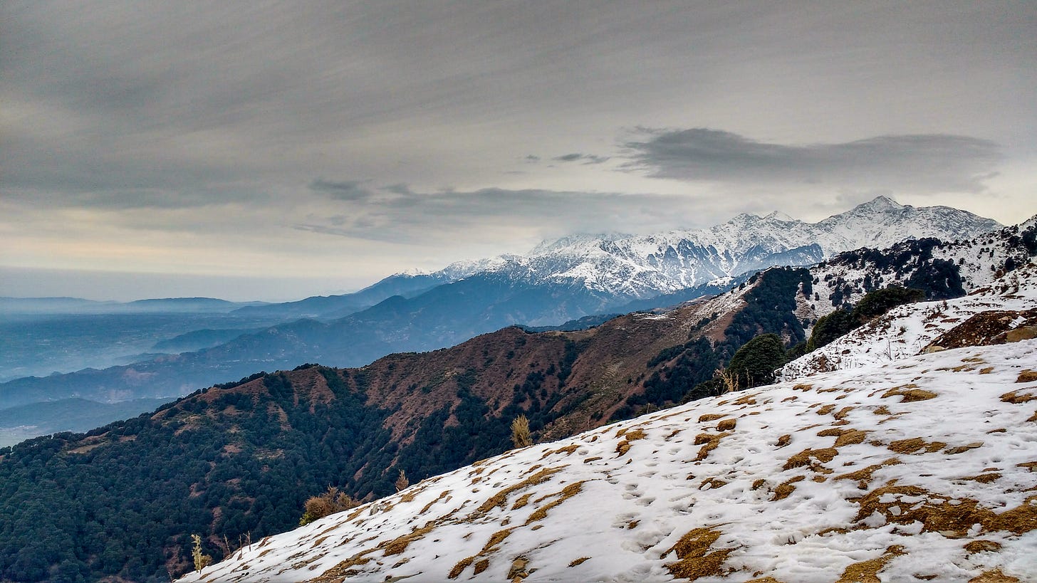
It was a cold Christmas eve in Dalhousie, Himachal Pradesh, when I started my first Himalayan trek as an ignorant but enthusiastic 16-year-old. For the first couple of days of the trek, we were mostly hiking through thick pine forests which occasionally opened up to small meadows. I didn’t know where I was, which part of the Himālaya we were in, but I was just happy to be there. On the third day, I started losing patience and wanted to go higher, where there would be lots of snow. As I laboriously climbed up to a ridge that evening, I finally saw a snow-clad mountain for the first time in my life. It was the 5650m high Maṇimahesh Kailāsh, towering above the surrounding hills.
It should have been an incredible moment. But far from being excited, I felt disappointed. I felt I was not on a Himālayan trek at all. Those snowy peaks far away in the distance, that was the Himālaya, not where I was standing. But Dalhousie - from where we started the trek - also receives snowfall. So what exactly is the Himālaya then? Do the lower hills also form a part of the Himālaya? Then why is there no snow here? I was perplexed.
After coming back home disappointed from what was supposed to be an important event in my life, I felt it was my own mistake of forgetting my high school geography lesson. The Himālayan foot-hills, the Shivalik range, were also considered a part of the Himālayas! But in what sense? It took me many years to truly understand the unique topography of this sub-range, the Shivāliks, or what I would like to call the first ridge of the Himālaya. It was only after I moved to Rishikesh and could see this ridge from my balcony that I started understanding its contours. The natural assumption is, that all mountain ranges start from the plains and gradually rise to their highest points before tapering down. But that is not the case with the Himālaya, and that is why the Shivāliks are special.
The Outer Rim of the Himālayas
If the Himālayas are a natural barrier between the Indian sub-continent and the Tibetan plateau, then the Shivāliks are a barrier between the Indian plains and the greater Himālayan range. It is a range within a range, a sub-range. It is hard to picturise this in your mind if you have never been there, so be patient as I try to explain this.
If you start climbing from the plains wanting to get to the great Himālayan range, you first encounter this ridge. The mountains don’t grow further in height from here, but instead gently taper down for several kilometres, only to rise again. This means the Himālaya doesn’t grow gradually like most mountain ranges. It rises - all the way to ~3000m/10,000ft - only to go down or taper off to an average altitude around 1200m-1500m. However, the next time it rises, it goes all the way to 6000m/20,000ft at the very minimum. The region where the mountains rise for the first time, so to say, is called the Shivāliks. The below illustration of the map of Uttarakhand should help you understand the topography better.
In the above image, the line marked in red is the first ridge - its altitude ranges from around ~2000m to ~3000m. The area shaded in green which is behind the first ridge, are parts where the altitudes are lower (600m-1500m) than that of the ones marked yellow and red. The altitude starts rising again from the areas shaded in brown. All these areas - marked yellow, green, brown - receive snowfall only in the winters, hence do not qualify to be called the Himalaya technically.
Ālaya (home) of Hima (snow) would mean that there is snow 24x7 - 365 days of the year and that is a special attribute that only applies to areas where the snow never melts, i.e., roughly speaking, places above 5000m/16,500ft (shaded white). But that number is highly dependent on the region. In the trans-Himalayan regions like Ladakh, you can go up to 6000m/20,000ft without finding any snow in certain seasons.
Higher than you might imagine
This first ridge is special because of two reasons - proximity to the plains and its altitude. The points on the ridge are as high as 2800m in certain sections. To put it in context, that is higher than places like Joshimath (1850m), Manali (2050m) and even Devariatāl and Chopta in Uttarakhand which are at 2500m. These places are so close to the main Himalayan range and yet do not match up to the altitude of the Shivaliks, which are so far away. To add a bit more emphasis, even Kargil at 2676m is lower than the highest points on the Shivaliks.

Dauladhar the outlier
The Shivāliks span the entire Himālayan range - from the Indus river in the west to the Brahmaputra in the east. While the height and width of the range are not consistent throughout and altitude dramatically decreases in parts of Nepal, we still find prominent high points on this ridge across regions. Patnitop while entering Kashmir, Dalhousie, Kufri and Churdar in Himachal Pradesh, Mussorie, Surkanda Devi and Nainital in Uttarakhand, Darjeeling in the eastern Himalayas are some popular high points on this range.
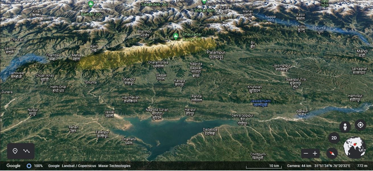
However, there is one region where the big mountains rise directly from the plains without a prominent first ridge. That is the area between the rivers of Rāvi and Beas, called the Dhauladhar range. The peaks in the Dauladhars dramatically rise as high as 5000m. It is hard to find another example anywhere in the Himalaya where mountains of that altitude rise in such a short distance. This is the reason why during the covid lockdown, people from the plains of Punjab could see the Dauladhar range standing like a wall.1


‘The’ place for Himālayan panoramas
The Shivālik range offers some of the best panoramic views of the great Himālayan range. The sheer horizontal expanse of the view is astonishing. When I visited the Kunjāpuri temple, a high point on the ridge right above Rishikesh, I could not believe what I was seeing. On the far east, I could see the Nanda Devi, towering over the entire range. To the east, I could see peaks even beyond the Bandarpuūnch massif. If you seem lost with these names, it means nearly the entire mountain ranges of the state of Uttarakhand and even peaks of Himachal Pradesh, spanning multiple hundred kilometres in width, are all seen from a single point!

The expanse of the view available from this ridge is because it is far from the main range, yet tall enough. When you go on treks deeper into the Himālayan range, you can get to see the big mountains up close, but you can never really see so many peaks at any single point. The only way to get even more expansive views is to actually climb one of those big Himālayan peaks!
The sacred ridge
The credit of making these ridges of Shivāliks popular is unduly given to the British, who built many of their cantonments/ royal residences here. But these ridges are dotted with temples that have connections to Indian itihāsa and purāṇas. Some of the temples themselves date back at least to 8th century CE. To take an example of Uttarakhand, the ridge between the Ganga and Yamuna rivers has three Shakti-sthals or Shakti-peeths - sacred spots connected to the well-known story of Shiva and Sati 2.
The temples of Kunjapuri, Surkanda and Chandrabadni mark the locations where Sati’s chest, head and torso fell, respectively. All three temples are located on dramatic high points of the ridge. I wouldn’t be exaggerating if I say these temples offer some of the best panoramic views of the Garhwal Himalayan peaks.

When one sees so many prominent mountains - all of them sacred in themselves - standing in one place, it is hard not to feel that the location is indeed powerful. Even though the temple of Surkanda Devi is nearly 1000m higher at 2750m, my experience at Kunjāpuri temple was extremely special, even overwhelming. There is something special about the place that is inexplicable.
I cannot point to one single reason why. Maybe because I unexpectedly saw Nandā Devi from so far away, or that I could get an areal view of the Ganga leaving behind her mountains and entering the plains, or maybe it was the temple itself. The time I spent at Kunjāpuri, and the fact that I could see the hill every morning from my balcony changed the way I looked at the Himālaya. It changed the way I looked at the Shivāliks and the surrounding hills. It got me fascinated about this unique topography and made me observe the features of the Himālaya with a lot more attention.

Every region, every topography has something special, something unique about it that can be found nowhere else. As a teenager, I wanted to go high, wanted to climb big mountains, so I could never appreciate the lower hills enough. I frequently dismissed hiking in the lower hills and compared them to hiking in the western ghats. Kunjāpuri made me realise how wrong I was. It is amazing how seeing a sunrise from a particular place can change your perspective so much. But that is the thing about the Himālaya, if you are willing to learn, it never stops teaching you :)
So that is it for today. Hope you enjoyed reading! And the next time you visit the Himālaya, do try to keep a day to explore the lower hills. If you have already been to the Himālaya, just think about which part of the range you visited, it would be interesting to know, no?
In the next post, I will write about the Ganga and why it is considered a sacred river. I will write about the pancha-prayāgas or the five confluences of the river before it reaches Rishikesh and also try to reason why people from across the country come to Haridwar to take a dip in its waters and not any higher.
Until next time, Namaskāra :)


Interesting read . Hadn't read much about Shivaliks.
Interesting reading.