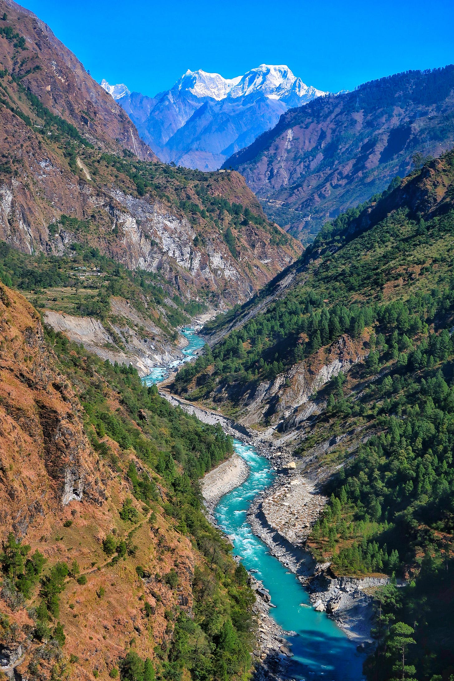
It was the spring of 2013 when I first visited Uttarakhand as an eighteen-year-old. I was on my way to Nehru Institute of Mountaineering for my basic mountaineering course. The institute is located just above the town of Uttarkashi, on the banks of the Bhagirathi river. Every day, as we crossed the footbridge over the river on our way to the rock-craft training area, I couldn’t stop thinking about the wonderous turquoise-blue waters of the river. Being ignorant as I was, I kept calling the river Ganga as I knew the river originated at Gangotri. But my coursemate from Uttarkashi kept on correcting me, saying this was the Bhagirathi and not the Ganga. I couldn’t make sense, isn’t the Bhagirathi just another name for the Ganga?
The answer he gave me did not satisfy me then. And it took me a long time to understand why the name Ganga was given to the river only at Deva-prāyaga, where the Bhagirathi and Alakananda met - not before, not later. In fact, it was only after I understood the mountains of Uttarakhand that I could understand the river systems of Uttarakhand, which makes Ganga what it is, a sacred river.
Birth at a confluence, not at the source
We have seen in the previous post, the names of the mountains surrounding the Gangotri glacier which contribute to the water that flows at Gaumukh, believed to be the source of Ganga. But the very same mountains that form the watershed of Bhagirathi river at Gangotri, also feed the Alakananda river which flows in the Badarinath Valley or the Mandākini river which flows in the Kedarnath Valley. So on that basis, any of these rivers can be attributed as the sources of Ganga because they are fed by the very same mountains.
In fact, hydrologically, Alakananda is considered the source river of the Ganga because it is longer and also the quantity of its water discharge is higher compared to Bhagirathi. That said, these two rivers are not independent streams but are fed by innumerable streams - big and small. So in such a case, how does one attribute one stream among thousands - if not lakhs of tiny streams - to be the source of the Ganga?
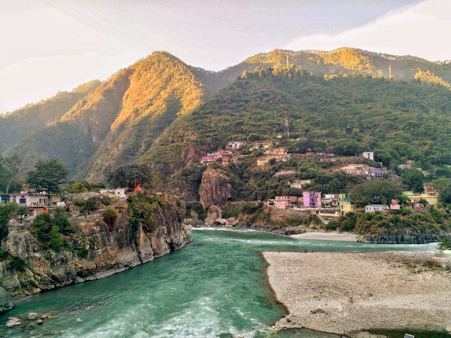
This is the reason Ganga, in a sense, is born not at the source but at a confluence. Each and every stream contributing to the river is no less than the other, and hence, it is only logical that one is not called the source, while others are called the tributaries. Hence, the name Ganga is attributed to the river only after the confluence of Bhagirathi and the Alakananda rivers at Deva Prāyaga - literally, the confluence of god(s) - which is a confluence of the waters of thousands of streams, originating from the mountains of Uttarakhand.
The Pancha Prayāgas - Confluences before the big confluence
The source of the Alakananda river is behind Badarinath, one of the holiest sites - a Thīrtha kshetra - for practising Hindus in India. It flows from two glaciers which are right behind the Gangotri glacier. The same mountains that are at the very root of Gangotri glacier form the source of the Alakananda too - Chaukambha, Satopanth, Jahnukut (you can appreciate what I am mentioning here if you have read the previous post).
The number of peaks that feed the Alakananda far outnumber the peaks that contribute to Bhagirathi. These cluster of peaks drain their water down to five major rivers, which all meet the Alakananda before Alakananda meets the Bhagirathi, and these five confluences are called the Pancha Prayāgas.
Right behind Badrinath near Māna village, the Saraswati River joins the Alakananda. The Saraswati river originates from Saraswati Parvat on the India-Tibet border and is fed by big 7000m mountains like Kamet, Mukut Parvat, etc. This confluence is called the Keshava Prayāga, the first of the five prayāgas before the Deva Prayāga.
The next big river that meets Alakananda is the DhauLi-Ganga, which is fed by even more prominent peaks like Nanda Devi, Trishul, Nanda Ghunti, Dronagiri, Kalanka, Maiktoli, etc. The DhauLi-Ganga also receives water from the east face of the Kamet-Mukut range. The confluence happens in a gorge below Joshimath and is called Vishnu prayāga.

Interestingly, the same mountains that contribute to the DhauLi-Ganga are the main contributors of the Nandākini and Pindar Rivers too. Nandākini gets its water mostly from Nanda Ghunti and Trishul, while Pindar receives water from Mrigthuni, Maiktoli and Nanda Kot cluster. The confluences of these rivers with Alakananda are called the Nanda Prayāga and Karna Prayāga respectively. You might be getting lost here with all these names but please bear with me till I present you the final picture.
The fifth confluence of Alakananda happens with Mandākini river which flows from Kedarnath, another sacred kshetra. The mountains of Mandani, Kedarnath, Chaukhamba, Karchakund, Sumeru, Thalaysagar, etc, drain their waters down the Mandākini which joins Alakananda at Rudraprayag.

That said, these five rivers are by no means the only sources of the Alakananda river, there are multiple independent streams like the Khirao Ganga originating from Panpatia glacier or Bhilahi Ganga originating from Nandagunti-Pangarchula-Kauri Pass region that joins the Alakananda.
Deva Prayāga - The grand confluence of Deva Bhūmi
Why did I write down soo many details which I know a reader who has not visited the region will never be able to relate? Just to illustrate the fact that when Alakananda meets the Bhagirathi, it brings with it water from pretty much all the mountains of Garhwal and Kumaon, the whole of Uttarakhand whi ic called the Deva Bhūmi - the land of the gods - a land where mountains are worshipped as a form of the divine.
The Deva Prayāga is where the water from Badrinath, Kedarnath, Gangotri become one. Where the water that flows from Bandarpunch, Swargarohini, Shrikant, Gangotri, Draupadi-ka-Daanda, Rudragaira, Kedarnath, Jogin, Jaonli, Satopanth, Shivling, Gangotri, Saraswati, Nanda Devi, Dronagiri, Trishul, Manda, Mandani, Chaukhamba and hundreds of other sacred peaks merge. Water that flows through dense alpine forests, meadows with medicinal herbs and rocks that were once in the ocean all converge and become one.
The name Ganga is given to the river only after this confluence. I am not sure how many rivers in the world take a completely different name after two rivers of different names meet (if there are any you know, please do mention in the comments). I can recollect only one other example in the Himālaya which is the Zanskar river in Ladakh - where the name Zanskar is given after the Stod and Tsarap rivers meet. But Zanskar eventually meets the Indus and loses its name. Ganga on the other hand keeps her identity all the way till she herself scatters into multiple streams close to her mouth near the Bay of Bengal.
Realisation at Kunjāpuri
I had driven by the Deva Prayaga tens of times earlier on my way to the high mountains, but the magnitude of the phenomena that I have just written about dawned on me when I was at Kunjāpuri temple (read more about it here).
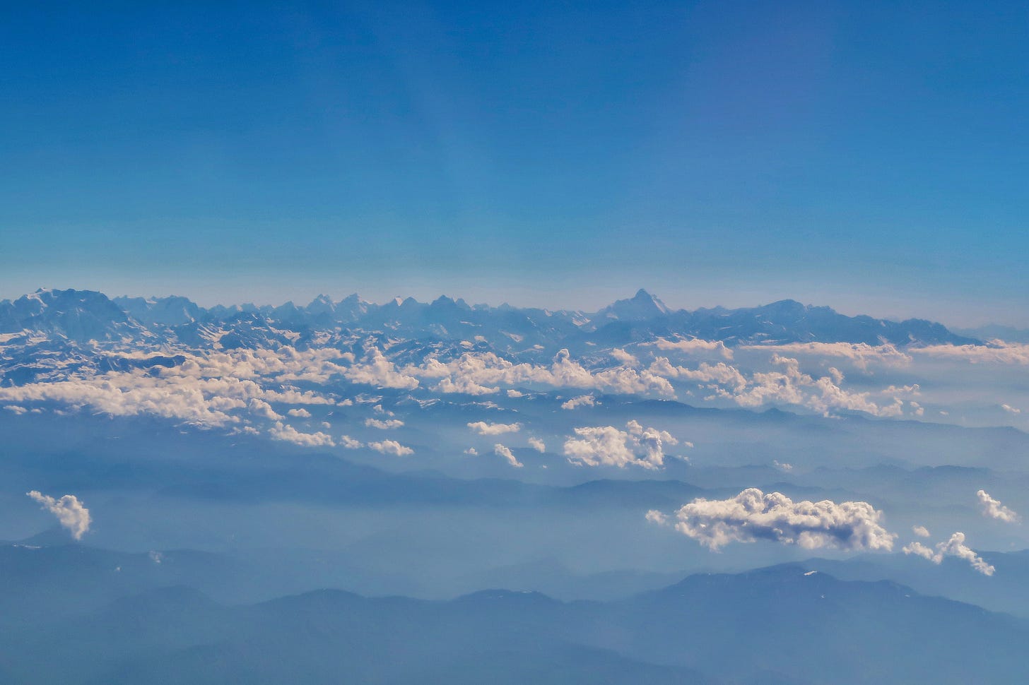
From Kunjāpuri, you get to see panoramic views of the Garhwal and Kumaon peaks on one side and the view of Ganga entering the plains on the other side. I had an ‘Ahaa!’ moment when I realised that the waters of all the peaks that I was seeing was flowing in the Ganga below. I thought of each and every peak - from Bandarpunch in the west to Nanda Devi in the east - all their waters reach the Ganga. That is when I realised that when you take a dip in the Ganga at Rishikesh, you take a dip in the waters draining down from each of those mountains - not one, not ten, but pretty much all of the hundreds of sacred peaks of Uttarakhand. That very moment, my perspective of the Ganga changed forever.

While the sacredness of towns like Rishikesh and Haridwar are indeed tied to historical events in these locations and the belief of practicing Hindus in these events, for me, these locations are representative of powerful geographical/geological features. Rishikesh is special because it is, in a sense, where Ganga’s journey from 7820m high Nanda Devi to 340m high Lakshman Jhula culminates - a descent of 7480m or 24,500ft. It is where the Ganga is released from the chaos of Shiva’s matted hair - to use the anology of the previous post. After this, she gently flows across the northern Indian plains, travelling nearly 2000kms to descend a mere 340m!
There is a reason why these locations are considered sacred in their entirety and their sacredness is not limited to just one spot or one temple in the town. That is why these places are called Thīrtha ‘kshteras’ - referring to the entire geographical location. There is no doubt that ancient Indians recognised the significance of certain geographical locations across the sub-continent - locations where people could experience the divine. Witnessing the Ganga at Rishikesh is truly one such experience. But when you also know the mountains and the thousands of streams that make Ganga what it is, what you experience in Rishikesh is even more surreal :)


surreal post.