#6: On sacredness of Kailāsa Parvata and the conception of Jambu-dweepa
What makes Kailāsh sacred for Indians, Nepalis & Tibetans? Why is Indian sub-continent called a dweepa (an island)? The post explores an incredible connection between these apparently different topics
Before performing a puja in Indian tradition or even during the daily sandhya-vandana performed by certain practising Hindus, there is a custom of reciting what is called a ‘Sankalpa’, where the Bhāratīya conception of space and time are invoked. If you are an Indian, there are high chances you would have heard it. It goes something like ‘Dwiteeya parārdhe, Shweta Varāha kalpe, Vaivasvata manvantare, Kali Yuge, Prathama pāde, Bharata khande, Bharata varshe, Jambu-dweepe…’ and goes further, mapping more precisely smaller units of time and the geographical location in which the Sankalpa is being performed. The first five concepts mentioned above are referring to different units of time, while the latter three talk about the space or the geography of one’s location. Every time I heard this Sankalpa or recited it myself, I always wondered why is Bharata - the Indian subcontinent - located in Jambu-dweepa (island)?
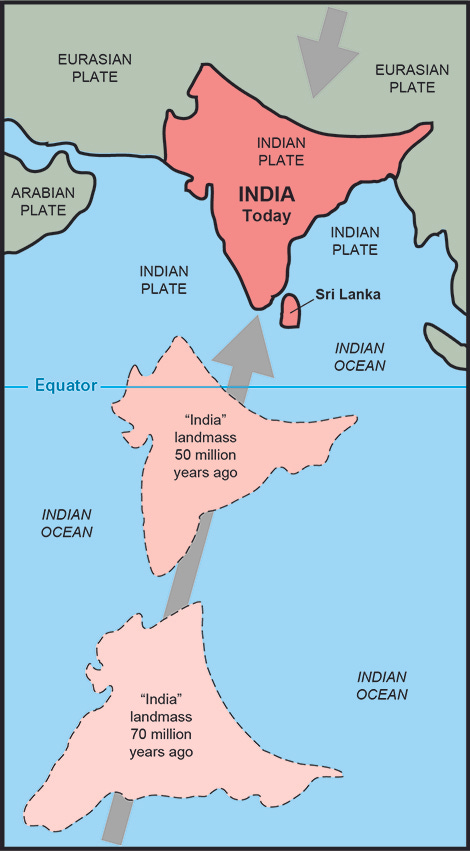
Is Jambu-dweepa referring to the time when the Indian tectonic plate was still an island? Before it collided with the Asian plate? It might be a fair assumption considering the term ‘Bharata Khande’ is used, Khanda is more likely to represent an independent continent or a geographical plate - the word is used in that sense even today in Kannada. But since both the conception of space and time are invoked together, the reference does not make sense. Clearly, today, Indian sub-continent is not an island! Or is it?
The reference of Jambu-dweepa
When I went in search of the concept of Jambu-dweepa, it lead me to Indian cosmological beliefs and the conception of the universe according to ancient Indian texts. The reason I use the term Indian texts is that the belief is not limited to Hindu texts, the same conception of the universe is found in both Jain and Buddhist texts. While I cannot explain the whole concept here, what I can say is that Jambu-dweepa as found in traditional Indian literature is not at all referring to the current Indian geography. In fact, it is a larger conception of the earth - bhū-mandala - in which Bharata khanda, the Indian sub-continent, is but a small part. So my search in this direction did not yield any results.
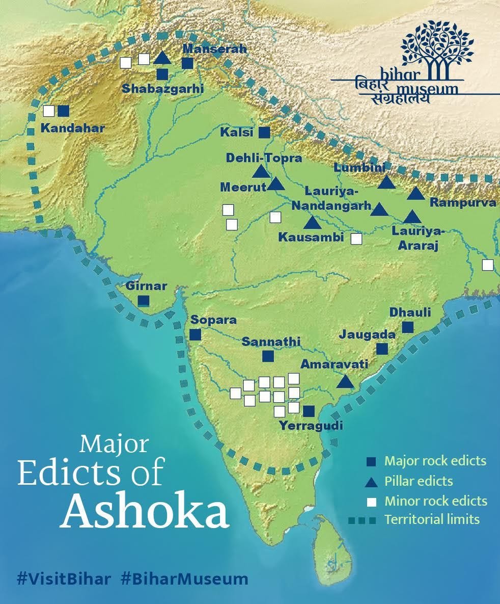
However, when I was cycling across Gujarat, I happened to visit the Girnar mountains, where I came across a rock-edict of Ashoka, the great king who lived ~2300 years ago. Seeing Sanskrit words inscribed on rock such a long time ago, I got fascinated by the fact that someone had managed to record events two thousand three hundred years ago and here I was reading them. I wondered if the person who etched it thought that people like me, millennia later, would be reading his words! Obviously, I was intrigued and read up more about the various rock-edicts erected by Ashoka across India. And what did I find? The term jambu-dweepa! in not just one, but in two of his minor edicts - one of them in Sasaram in Bihar and another being in the village of Maski, in my home state of Karnataka!
In both these inscriptions, Ashoka is referred to as the emperor of Jambu-dweepa. As you can see in the map above, he ruled the entire Indian sub-continent and erected such edicts across his empire, which gives us an idea about the conception of Jambu-dweepa according to Ashoka, and shows that the term indeed referred to the Indian sub-continent. Surprisingly, this is a departure from the conception of Jambu-dweepa as believed by Hindus, Jains and Buddhists (remember Ashoka was a devout Buddhist). Irrespective of religious belief, Ashoka clearly could see that his own empire is not a dweepa, i.e, not an island. Why then, do his edicts use the term? Here, I hit a second dead-end in my search :)
So, where do we go from here? Jambu-dweepa according to Indian cosmology is not referring to the Indian sub-continent (Bharata Khanda) and considers it only a part of the dweepa. Ashoka’s Jambu-dweepa is surely referring to the Indian sub-continent. So, in a sense, we can see a change in the perception of Jambu-dweepa over a period of time. While the ancient texts say the Indian sub-continent (Bharata Khanda) is a part of Jambu-dweepa, for Ashoka, Bharata Khanda is itself Jambu-dweepa.
That said, in what sense is the term applicable to the Indian sub-continent now? Especially if we continue to invoke ‘Bharata Khande, Bharata Varshe, Jambu-dweepe’ in our daily prayers? Here is my answer. It is a very subjective one, based on my own observations and reasoning. And as you would have seen me doing in all my previous posts, I turn to geography for answers. One can call it a stretch - it sure is - but it is as good an explanation as I could find. Let me know if it is convincing enough?
Indian sub-continent is an island?
What is an island anyway? ‘Island is a body of land surrounded by water’ says National Geographic Society. The Brittanica website says, ‘any area of land smaller than a continent and entirely surrounded by water’. It adds, ‘islands may occur in oceans, seas, lakes, or rivers’. Oxford dictionary says, ‘a piece of land completely surrounded by water’.
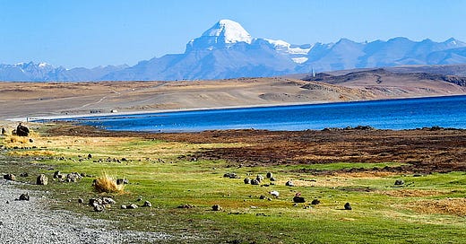
If we consider this as a working definition, the Indian sub-continent - the same land that Ashoka called jambu-dweepa, comes oh-so-close to being an island. Only a tiny, tiny piece of land - a single mountain - comes in the way. And that mountain is Kailāsa Parvata or what is today called Mt.Kailash near Mānasa Sarovara.
What makes Kailāsh Sacred?
When I was in Leh for the first time in 2012 and was trying to get a climbing permit to a peak on the other side of the Sindhu (Indus) river, the veteran climber who was among the first Indians to summit Mt.Everest, Sonam Wangyal, sat us down at the permit office and explained to us about the source of the Sindhu river. He took a sheet and drew a map with his old, wrinkled hands, showing how the Sindhu travelled from the foot of Kailāsh mountain, all the way to Leh. The reverence with which he spoke about it is when I realised that Buddhists rever the mountain as much, if not more than Hindus!
Mt.Kailāsh, the sacred mountain, is the reason why I said India can ‘almost’ be considered an island. The mountain is the source of two great rivers which surround the Indian sub-continent - the Sindhu and the Brahmaputra. The rivers originate from either side of the mountain and flow in two different directions - with Sindhu joining the Arabian sea and Brahmaputra joining the Ganga, before reaching the Bay of Bengal. Their respective paths literally mark the outer perimeter of the Indian sub-continent. Carefully observe this close-up map by US Geological Survey of the Kailāsh region (markings added for emphasis) -
What does this mean? If we consider water-on-all-sides as the definition of an island, the flow of Sindhu and Brahmaputra indicate that the entire north-western and north-eastern flanks of India is covered by the waters of these two rivers respectively. And of course, in the south, we have the ocean. So there we have it, the Indian sub-continent covered by water on all sides! And as I mentioned earlier, only the Kailash stands in between. That too in a sense is covered by ice, which is frozen water? :)

For me personally, this is what makes Kailāsh a special mountain. Because I have not had the opportunity to visit the region, I was always perplexed as to why Kailāsh is so revered. After all, many mountains in the Himalaya are revered and worshipped, and many of those mountains contribute to these very rivers - Ganga, Sindhu, Brahmaputra. But none of them come close to this sacred mountain in terms of their geographical placement. No other mountain anywhere in the Himalaya or probably in the world, gives birth to two rivers which flow over 3000kms each! The mountain is truly iconic. There is a reason why Hindus, Jains and Buddhists consider the geography around Kailāsh and Mānasa Sarovar so sacred. In more than a decade of hiking and climbing in the Himalaya, I have never come across a mountain, a single mountain, influencing the geography so much. Ironically, it was my search for the meaning of Jambu-dweepa that made me to realise the importance of the location of Kailāsh!
To conclude, I am sure the ancient Indians did not use the term Jambu-dweepa to mean that the Indian sub-continent is surrounded by water on all sides. But I am curious to know if Ashoka did, considering the area which comes under this 'island’ matches exactly with the areas he ruled. I can never know if he indeed shared this perspective, but I was surely inspired by seeing the term in his edicts. This post, in a way, is an outcome of my attempt to make sense of his usage of the term. And also, to have a mental conception of the term whenever I chant ‘Bharata Khande, Bharata Varshe, Jambu-dweepe’ during my sankalpa!
That is it for today! Hope you enjoyed reading this :)
If you enjoy such stories that explore the geography, culture and philosophies of India, do consider subscribing to this newsletter!


All the more reason why Chiam should not own mt.kilash. They don't comprehend its importance
Awesome post. A lot of mythology, religion, rituals and our culture is heavily influenced by Geography. You tying this up makes so much sense. Even I have been wondering for long on why so much hullabaloo about Mt. Kailash (unlike river Ganga which sustains so much life along its away and hence can be godly). This makes it easier.